From Newsgroup: sci.geo.satellite-nav
MJP wrote:
OSMAND
https://osmand.net/
Thanks for that suggestion of OSMAnd~ which I've had on my phones for years
<
https://f-droid.org/en/packages/net.osmand.plus/>
Unfortunately I don't think it does what is being asked for.
There are reasons I can get into but that would be an aside as what I'm
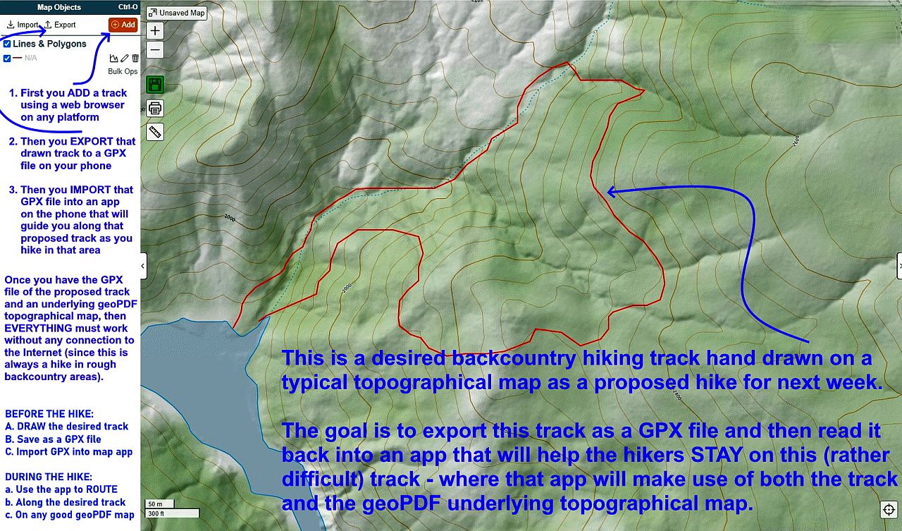
seeking is _off trail_ routing along a given featureless GPX track.
An example of what this proposed track might look like is shown below.
<
https://i.postimg.cc/wjHZRyQv/hike01.jpg> Draw track & export GPX
Once the GPX file is imported into the map program, the goal would be
_audible directions_ such as "Go West 100 Feet to Stay On Track".
Optionally, some intelligence might be useful as it would need to know the direction you're traveling on that track and then it could compute a
forward connecting hypotenuse to get you back on track efficiently without always rubberbanding exactly to the track.
I don't even know if backcountry routing exiists, so that is my assumption
of how it would work if such a capability does exist.
Does it?
Does _anyone_ on this newsgroup do backcountry off-trail hiking & routing?
If so, what app do you use to keep you on the proposed GPX track?
--- Synchronet 3.21a-Linux NewsLink 1.2